SOTA activation of Triglav S5/JA-001 in Slovenia

I was still missing a few stages to completely finish the relatively new Alpine crossing from Salzburg to Trieste. In 2018, I had hiked from Salzburg to Tarvis. The town of Tarvis is in Italy and is located on the border with Slovenia and Austria - it’s effectively the border triangle. In the absence of sufficient vacation days, I could not hike the stages in the Julian Alps at that time in such a way that I would have been able to get back home (reasonably) from there. So at that time I hiked from Tarvis towards the capital of Slovenia; to Ljubljana. The city is beautiful and was worth a visit.
The planning#
As I was planning the hike at home on my computer screen, I also kept an eye out for SOTA peaks along the GPS track of the hike route. A GPX track can be uploaded on the website https://sotl.as/. This track is then displayed on the SOTA map and so peaks along a trail can be identified very efficiently. Unfortunately, not too many peaks were in the immediate vicinity of the trail. I marked a few of the possible summits as waypoints with name and reference in my iOS navigation app “Guru Maps Pro”. However, there was one peak I really wanted to climb - the highest mountain in Slovenia - Triglav.
The equipment#
To better estimate the difficulty of the climb, I watched a video of a climb where one could see the difficult parts quite well. After that it was clear to me that the mountaineering helmet and gloves have to be in the luggage, but the heavy via ferrata set can stay at home. Since I pay a lot of attention to pack size and weight when it comes to equipment, I decided to take the Petzl Sirocco helmet with 170g weight. The total weight of my backpack including tent, down sleeping bag, sleeping pad and a lot of technology stuff was at a minimum of over 10Kg net, so that I then gross (including food and water) came to about 12.5Kg.
Waiting for the right moment#
Unfortunately, when I started the hike and approached Triglav, the weather forecast for the coming days was not satisfactory at all. Rain and thunderstorms were forecast for the entire Triglav National Park, so I took the bad weather route and descended into the valley to Trenta to sit out the bad weather at the campsite. I took a break day and made the decision not to climb in one piece from Trenta to the summit, but only to the Refugio Koča na Doliču at 2200m. I then wanted to venture the ascent the following morning. To ascend from Trenta in one day would mean to climb almost 2250 energy-sapping meters of altitude in one piece. You can do that, but if you want to continue hiking in the mountains for two weeks afterwards, it is not recommended to strain your body so much (if you have the choice).
The ascent to the mountain hut#
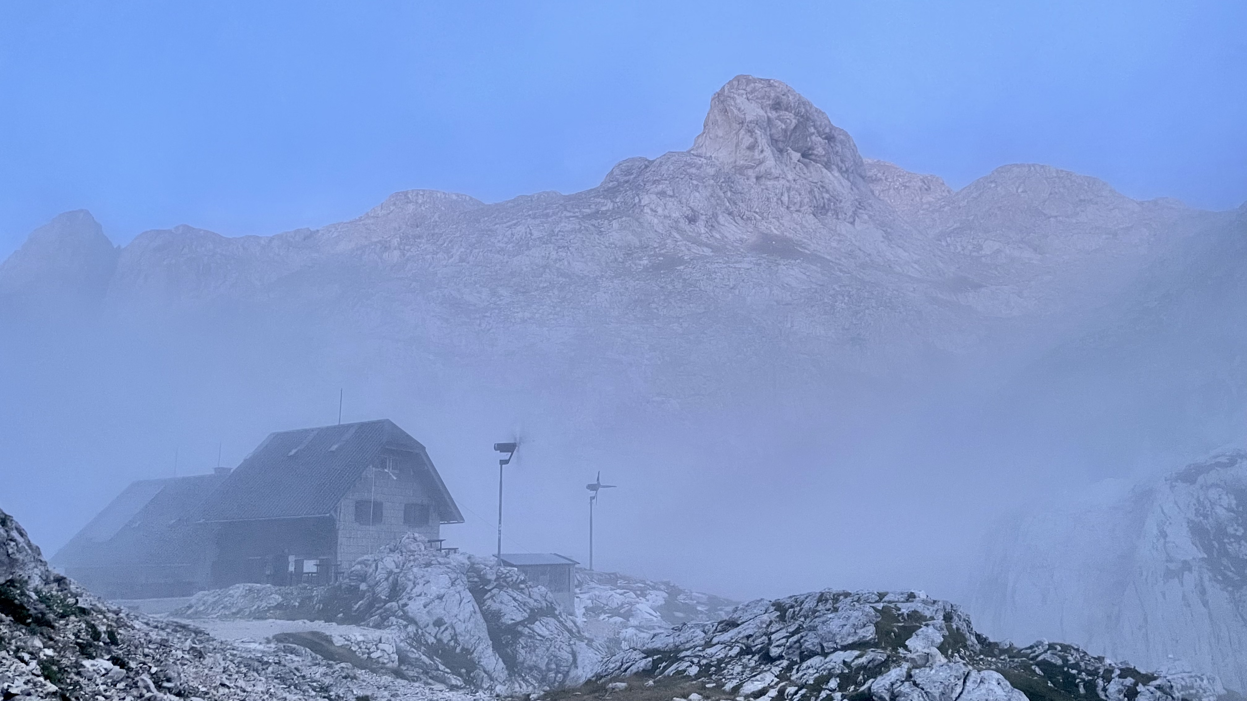
I slept in my tent at the lovingly run campsite “Camp Triglav” just under a kilometer from the small town of Trenta. On Monday, August 8, in relatively bad weather (light rain, heavy clouds, strong wind) I started the 1600 meter climb to the mountain hut. For Tuesday, the day of my planned ascent, perfect weather was announced - no clouds, but sunshine. However, only 5 degrees Celsius at the summit. So everything had to go quite quickly if I did not want to cool down strongly.
The summit climb and SOTA activation#
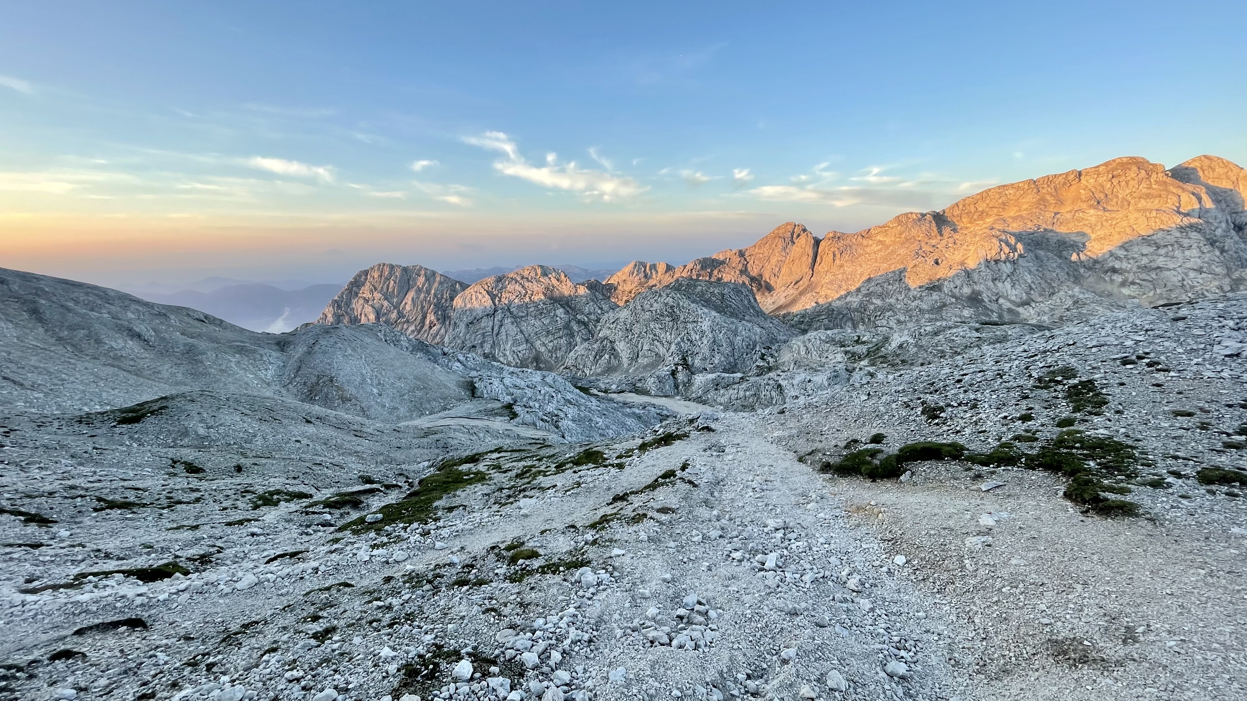
My Garmin sports watch vibrated me out of sleep at 0500 on August 9, 2022 and my heart rate was immediately on the edge, that’s how excited I was. I peeled myself out of the silk ticking and slipped out of the dim cabin so as not to wake the room neighbors. It was still too early for breakfast. I had packed a cheese sandwich that I wanted to eat on the summit.
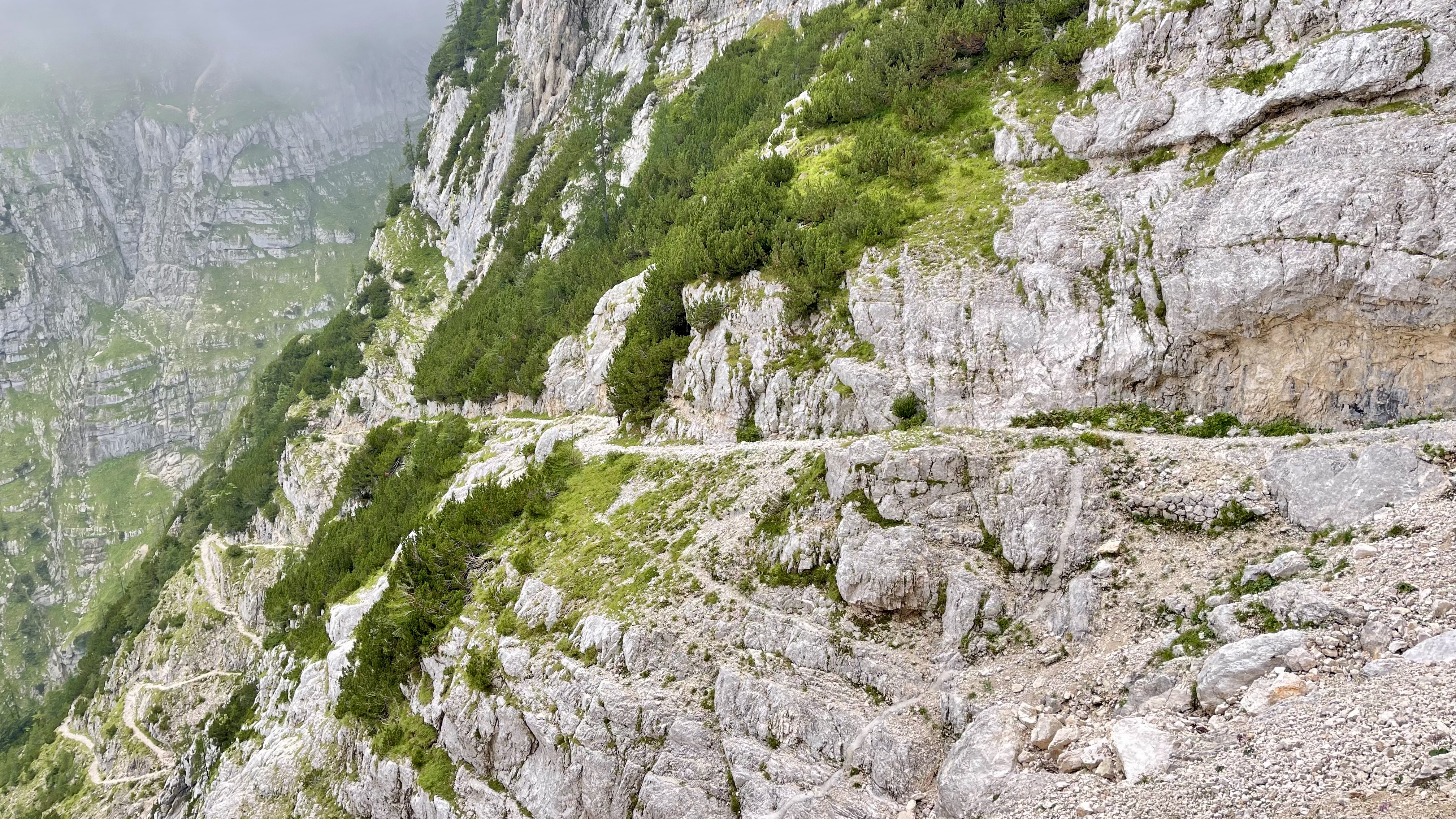
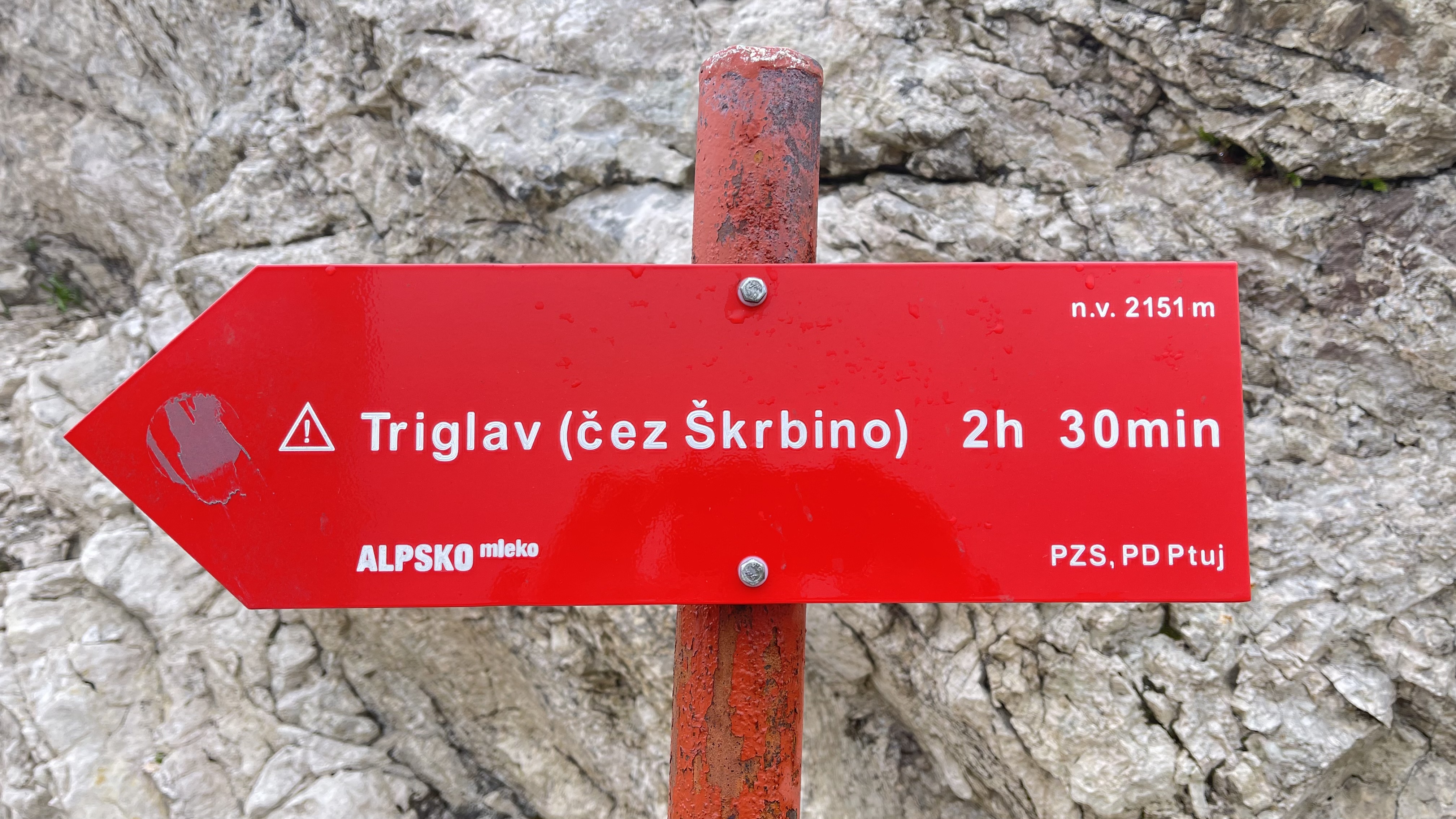
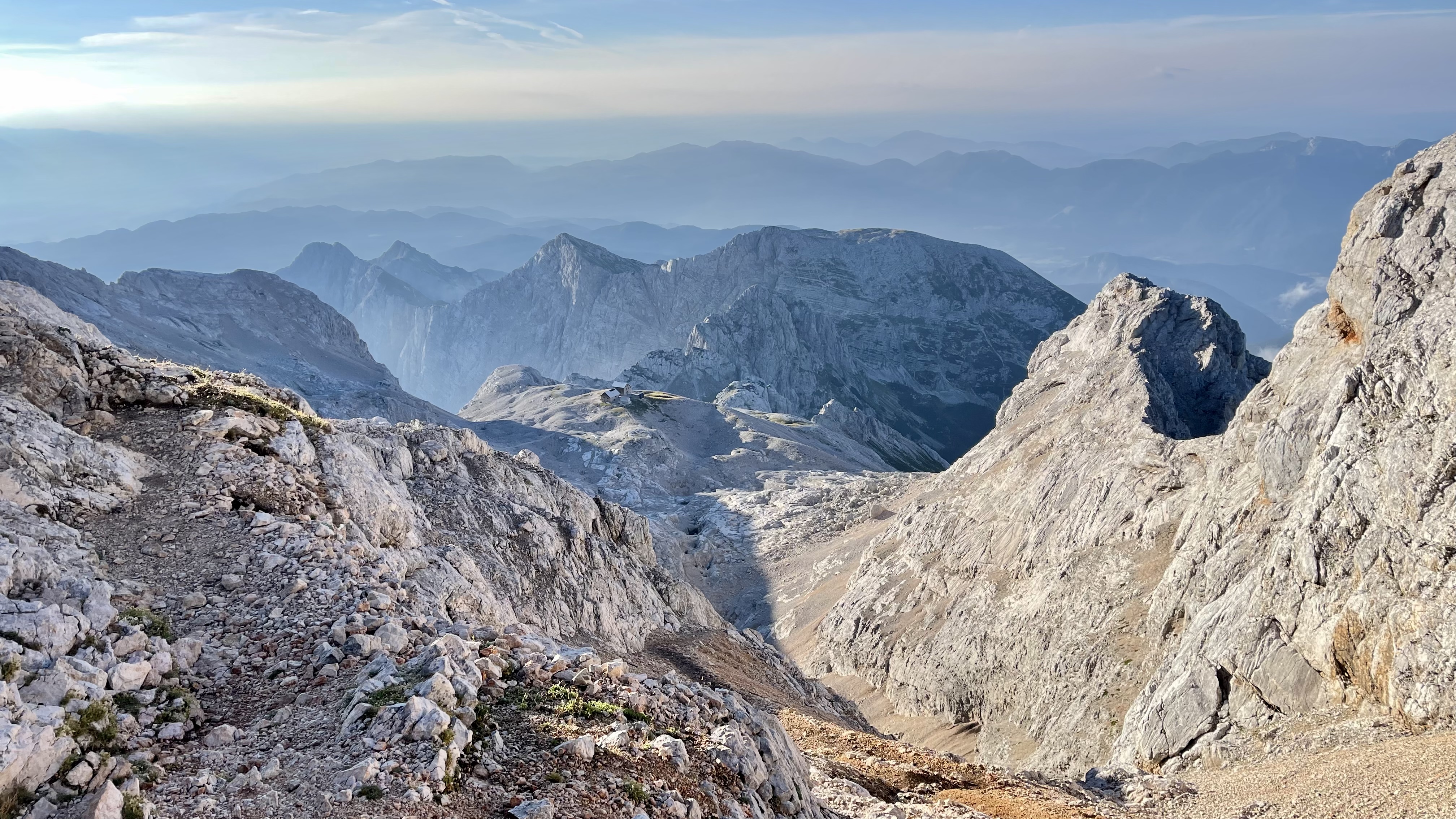
At 0530 I was on the hiking trail to Triglav, which branched off directly from the hut. The sun had not yet risen but it was already bright enough to see the steep, rocky path and the good trail markings. Technically demanding it should be only after an hour of ascent, until then I continued to climb concentrated and full of anticipation. The wind was blowing strong and cool. It dawned on me that I should soon put on the “full gear”, consisting of a thick fleece jacket and a hardshell jacket.
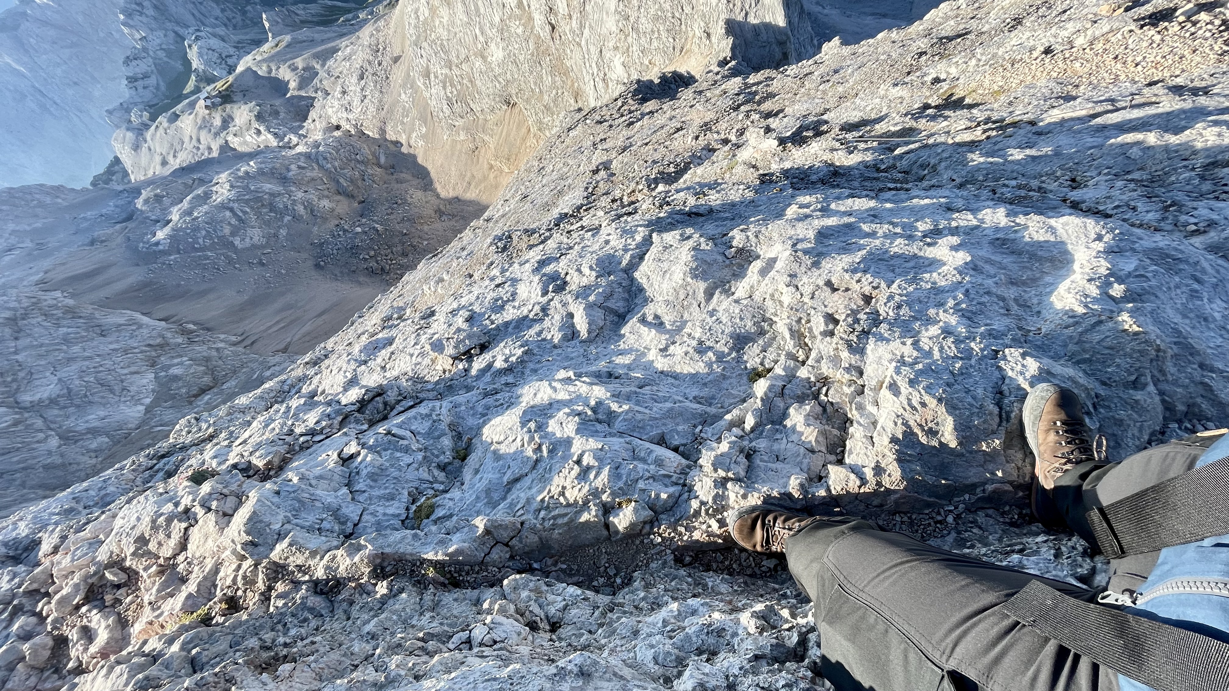
After an hour, I reached the very steep climb over a scree field to the start of the scramble to the summit. I put on the warm clothes, put the hiking poles in the side pocket of the backpack, put on the climbing helmet and put on the gloves. Let’s go!
It also started off well right away with some very exposed spots, steel ropes and steel nails to shimmy along the rock, whose footing was sometimes not much wider than your shoe. Every step required full concentration, every grip was well thought out and the body’s center of gravity was always close to the rock. After 20 minutes, the most difficult parts were overcome. The path was still very steep and demanding but no longer technically challenging.
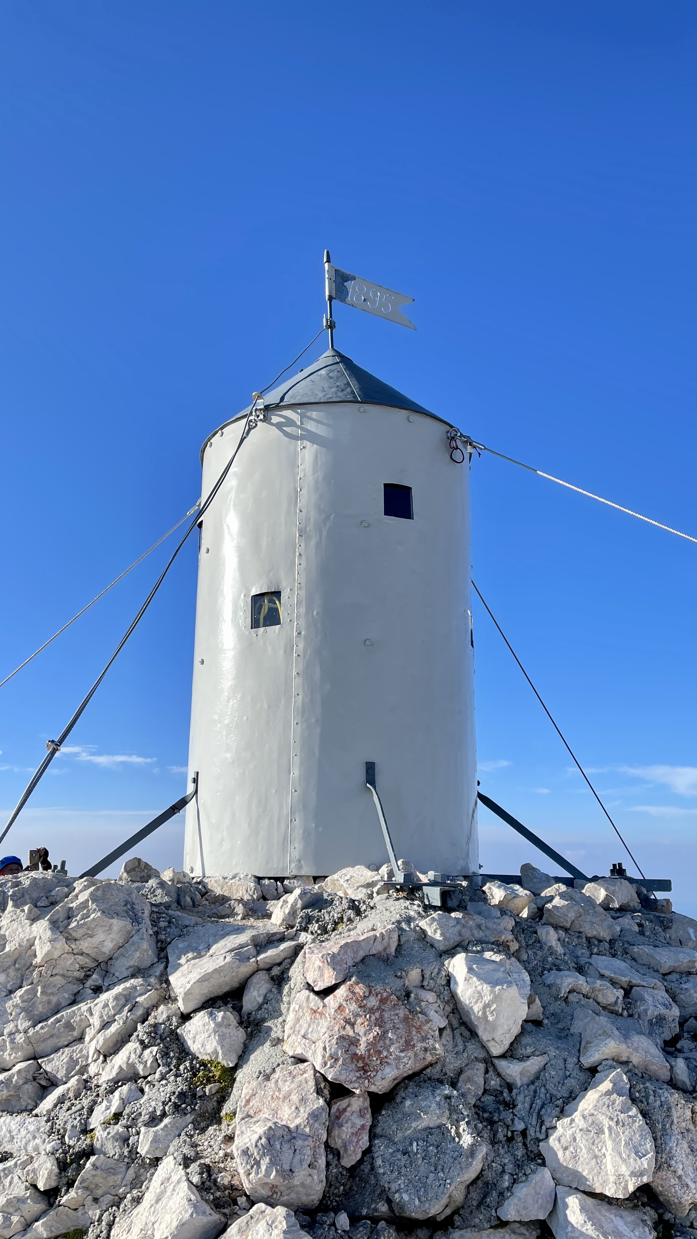
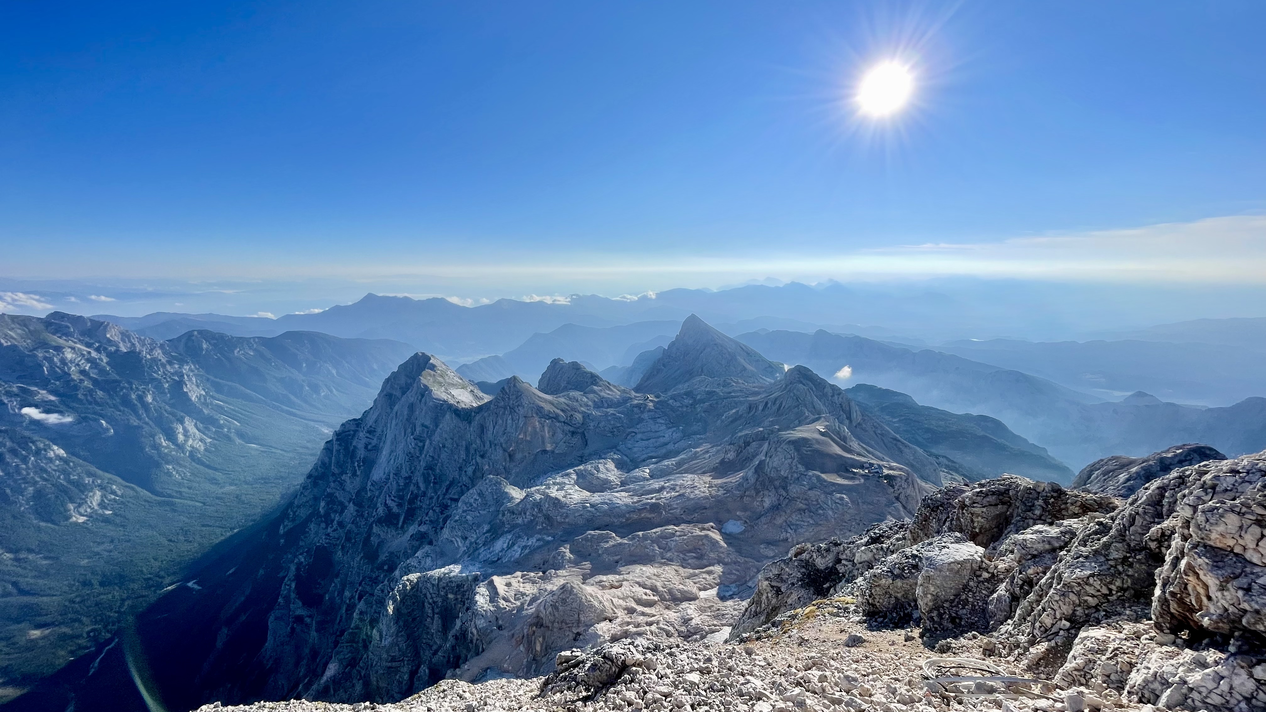
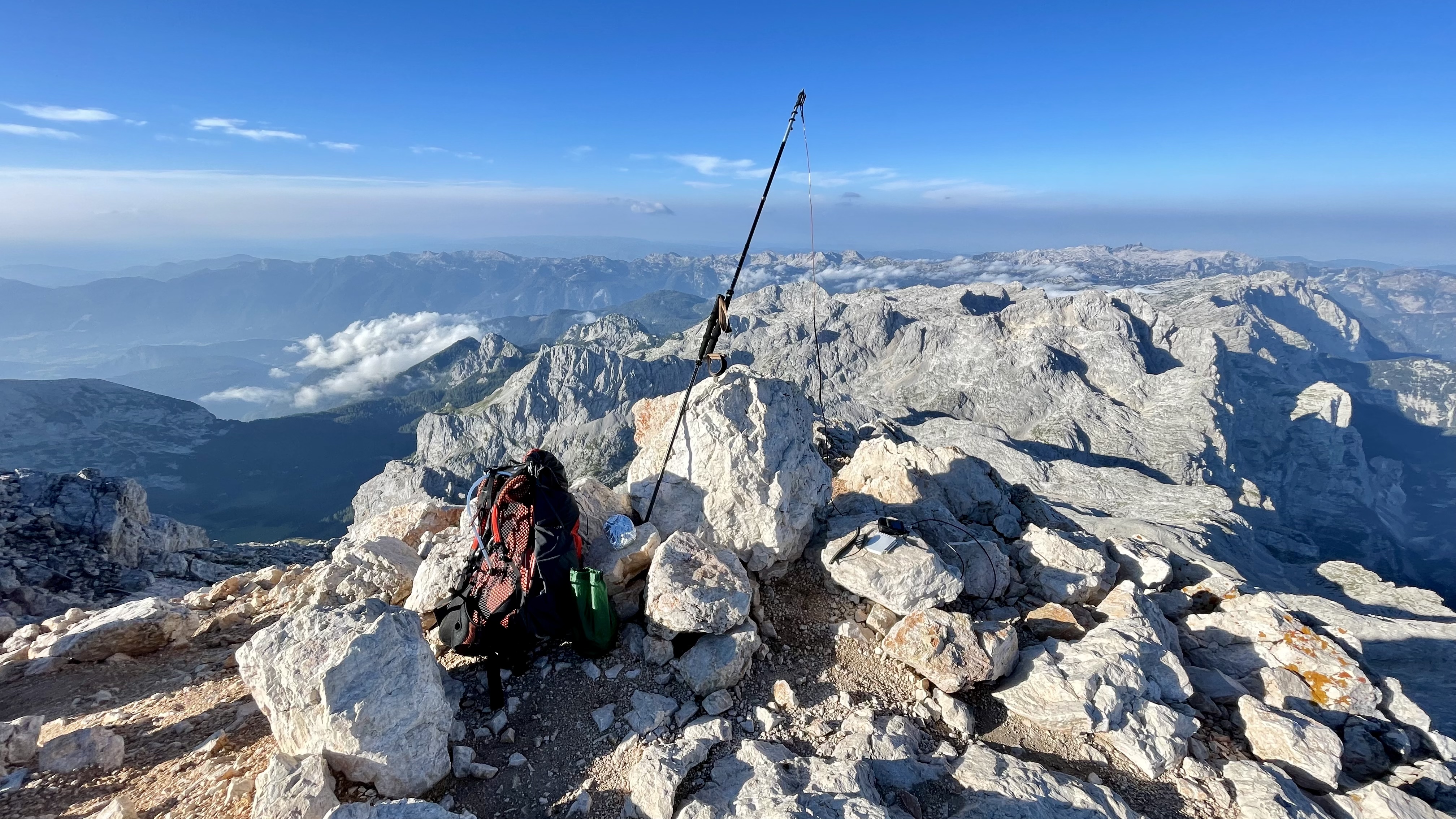
Much faster than expected, after two hours I already spotted the summit from a short distance and the last meters passed, fueled by the joy, as if in flight. At the top I enjoyed the breathtaking view. A 360 degree panorama that I will never forget! After I had taken the obligatory photos and videos, I looked for a suitable place a little bit away from the summit for the setup of my antenna. I had again the omnidirectional 2m/70cm wire antenna from Lambdahalbe with me, which had already served me very well at my last activations. I extended my two walking sticks to their full length and wrapped Velcro around the handles, so that it resulted in a stable, long pole, which I clamped between two stones. At the end I wrapped a rubberized wire and formed a hook into which I hooked the antenna.
My little Yaesu FT-5D 2m/70cm QRP handheld radio was quickly plugged in, turned on, and I activated the audio recording to SD card to record all the conversations. In the cold I would hardly be able to record the callsigns with pen and notepad over a longer period of time, so I left it alone.
At about 0745 CEST I was ready and started to call “CQ SOTA” with my call sign S5/DO1MJ/P. I called a few times on 145.500 FM, but got no response. Ok, I thought to myself, go for it. It’s still very early. What operator is already in the shack at this hour? On 145.550 I heard two Italians talking, who made very long passes and unfortunately didn’t notice my break calls. Too bad - that could have been the first two QSOs. So I called again on 145.500 - my frequency announced by SOTA alarm - CQ SOTA.
The time passed and inwardly already first thought bubbles appeared that I could not activate the summit, since it was perhaps simply still too early in the morning. But then suddenly I heard S52CU, Mirco from the capital of Slovenia, Ljubljana. I was overjoyed and regained some hope. Mirco was received at 5/9 and we had a very nice QSO. Ljubljana I thought - wow - that had been the goal of my hike in 2018. And also: connection between the highest peak and the capital of Slovenia? Super cool!
The second QSO came about a short time later with IK/OE5PSO/M, Peter, who was on a mobile near Trieste (Italy). Trieste - the destination of my hike - fits!
The third and with about 180km distance also farthest QSO I had after my breakfast break with 9A5EX, Herman from near Zagreb in Croatia. Slowly hope spread in me that I could make it! I scanned a little through the frequencies and called on suspicion on the meanwhile vacant frequency 145.550 CQ SOTA.
Immediately after my call, Chris, OE8CKK/P, who was on his way up to a SOTA activation of “Hoher Trieb” (OE/KC-066) in Austria, called in. I was overjoyed with the fourth QSO and thus the successful activation of Triglav, S5/JA-001! Unfortunately, Chris still needed a good hour of ascent to his summit, so we could not make a Summit-to-Summit connection, because for me it had now become time to pack the things and descend. I already began to shiver - a clear announcement of the body to move and generate some heat.
On the way down, I found and logged the geocache “Triglav 2864” GC14N3H - my highest cache so far. I also heard OE/S52AU/P, Borut, calling CQ SOTA on the summit of OE/KT-097 and was able to help him as a chaser with a very nice QSO.
This made the day perfect for me! After the two hour descent, I completed another five hour hike to my destination for the day. It was a long, exhausting but very eventful day, which will be hard to top and will always remain in my memory 🤩